David Roseman
June 24, 2012
Issues related to dredging volumes
June 24, 2012
Issues related to dredging volumes
Frode Maaseidvaag and I re-sounded the Pentwater channel on 6-22. We used the Garmin 441s fishfinder and UnderSee Explorer described elswhere. The equipment was mounted on Phil Ceton's Shuttlebutt, an approximately 14 foot long center console boat.
We do not claim to be experts in this technology, but think that the data are valid. We hope to repeat the studies fairly frequently, to gain experience and data.
The depths were significantly deeper than when plotted March 24, 2012. This did not seem to be a function of Lake levels. According to the USACE site, the Lake appears to be only about 0.2" higher. We have recently had significant precipitation, and wonder if this increased the flow in the Pentwater River sufficiently to wash out some sediment. Since the channel has a long history of shoaling, it seems likely that the next onshore storm will cause the sandbars to re-build.
The program supports the definition an "area of interest." For our purposes, this is the area for which excavation volumes are calculated. The first 2 charts below correspond approximatley to the area charted by the USACE in March, 2012. Because the bottom is deeper than in March, the third chart was drawn to show a wider area Following are the charts and dredging volume calculations. Note that the color code varies from chart to chart.
March 22, 2012 data
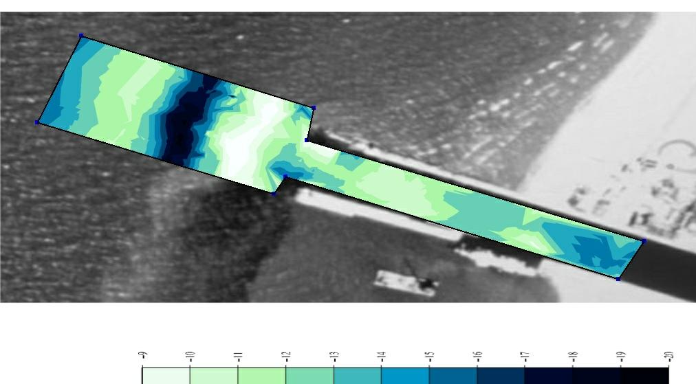
June 22, 2012 data
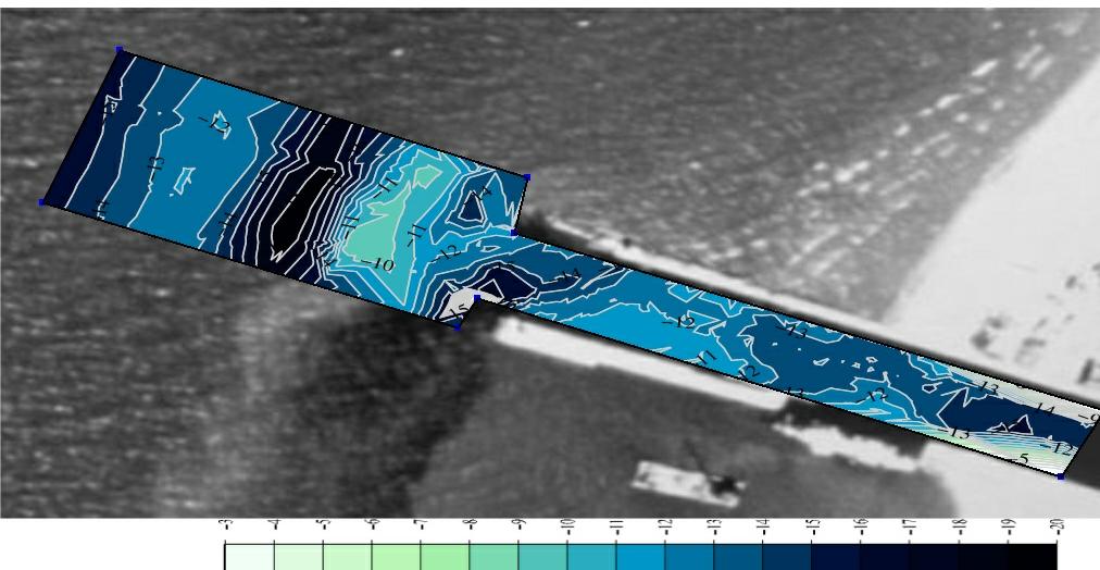
June 22, 2012 data with expanded area of interest

Calculated dredging volumes
| 3/16/2012 | 6/22/2012 | ||
| original area | expanded area | ||
| depth (ft) | cu yds | cu yds | cu yds |
| -18 | 50571 | ||
| -17 | 42017 | 30102 | 39372 |
| -16 | 33702 | 23789 | 31115 |
| -15 | 25672 | 17691 | 23139 |
| -14 | 17966 | 11909 | 15576 |
| -13 | 11204 | 6916 | 9046 |
| -12 | 5751 | 3265 | 4270 |
| -11 | 2328 | 1240 | 1622 |
| -10 | 585 | 439 | 574 |
| -9 | 86 | 52 | 68 |
One major question is about the upcoming dredging. Since we have funds for the maximum allowable dredging, it looks like we should use the expanded area of interest. Should this be skewed? I will try to get a professional opinion.